+ Are your drone operators licensed and insured?
Yes, all of our drone operators are FAA Part 107 certified, as required for commercial drone operations. Additionally, all of our commercial flights are insured through well-known drone insurance companies, ensuring coverage for your project.
+ How do you comply with local regulations and airspace restrictions when operating drones?
We comply with local regulations and airspace restrictions by following FAA guidelines and obtaining necessary approvals for every flight. Our FAA Part 107 certified drone operators conduct thorough pre-flight planning, including checking airspace restrictions and using LAANC (Low Altitude Authorization and Notification Capability) for quick approvals in controlled airspace. However, some areas have strict no-fly zones, and the FAA may require up to three months notice for approval, especially near busy airports and helipads. We stay informed on all relevant regulations to ensure our operations are safe, legal, and compliant.
+ Can drones work in all weather conditions?
No, drones cannot operate in all weather conditions. We fly only in safe and optimal conditions, such as clear or light overcast skies with light winds, and always below the cloud layer to maintain visibility. We do not fly in high winds, rain, or snow, as these conditions can affect flight stability and damage equipment. Visibility is crucial—we must always be able to see the drone to ensure safe operation. Additionally, lighting conditions impact the quality of images, videos, and maps, so we schedule flights when lighting is best for capturing high-quality data.
+ What types of output or deliverables do you provide?
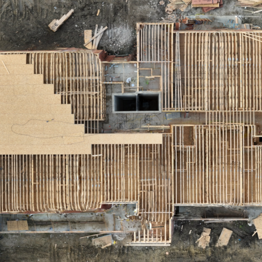
We provide a range of high-quality outputs to suit your project needs. Our main deliverables include images and videos, which are captured from various heights and angles to document your site. We also have the capability to fly over an area and take timed photographs, offering a comprehensive view of the entire project. In addition to images and videos, we create detailed two-dimensional orthomosaics, which are high-resolution overhead maps similar to Google Maps. These orthomosaics provide top-down views with geographical location data, making them perfect for use in GIS software such as ArcGIS and QGIS. If you're looking for specific types of outputs or additional information, please feel free to contact us.
+ How long does it take to complete a project?
No, drones cannot operate in all weather conditions. We fly only in safe and optimal conditions, such as clear or light overcast skies with light winds, and always below the cloud layer to maintain visibility. We do not fly in high winds, rain, or snow, as these conditions can affect flight stability and damage equipment. Visibility is crucial—we must always be able to see the drone to ensure safe operation. Additionally, lighting conditions impact the quality of images, videos, and maps, so we schedule flights when lighting is best for capturing high-quality data.
+ Can drones work in the dark?
Yes, drones can work in the dark, but there are significant limitations. The FAA requires specific lighting on drones for night flights. While night work is possible, we generally avoid it due to the challenges posed by limited visibility. The dark environment makes it harder to maintain line of sight with the drone and impacts the quality of images, videos, and maps. As a result, we typically reserve night flights for special circumstances and prefer to operate during daylight hours when conditions are optimal.
+ Can drones be used indoors?
Many drones are not designed to work indoors safely. Most commercial drones rely on stable GPS for navigation, which is often unavailable in indoor environments. Additionally, many drones are too large to navigate safely in confined spaces. However, there are smaller drones that are specifically designed for indoor use. While we currently do not offer indoor drone services, there are many potential applications for indoor drone work, including building and construction monitoring, architectural documentation, and inspection and maintenance of hard-to-reach areas. If you have a need for indoor data capture, feel free to contact us, and we can discuss how it might be safely achieved using the right equipment.
+ I didn't find the answer to my question in your FAQs. How can I get in touch with you?
If you have any questions or need further information that isn't covered in our FAQs, please don't hesitate to reach out to us directly. We're here to help! You can contact us through the contact form below and we’ll be happy to discuss your specific needs or provide any additional details.