+ How do drones help in construction and engineering projects?
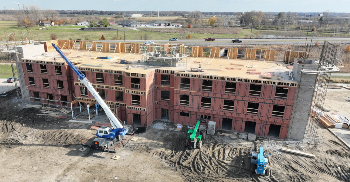
Drones help in construction and engineering projects by providing fast, accurate aerial mapping and data capture. They create high-resolution images and 3D models to support planning, design, and progress tracking throughout all phases of a project. Drones improve safety by accessing hard-to-reach areas and save time and money by reducing the need for manual inspections.
+ How much does drone flights for construction cost?
Drone flight costs for constructioncan vary depending on the specific needs of your project. We take into account several factors such as mission setup time, data capture duration, turnaround time, the types of deliverables you require, and the effort involved in processing the data. Additionally, precision and resolution requirements are important considerations that impact cost. Higher precision or resolution, such as those needed for detailed orthomosaics or georeferencing, may require more advanced equipment or additional processing time. Generally, single flights tend to be more expensive compared to milestone or scheduled flights, as there are added benefits of scale for recurring flights. We recommend reaching out to discuss your unique project requirements so we can provide you with an accurate and tailored pricing estimate.
+ What kind of data can you collect with the drone?
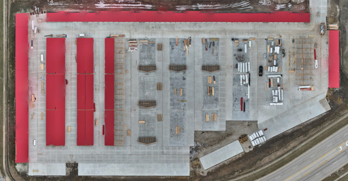
With our drones, we can collect a variety of data, including high-resolution images and videos, orthomosaics, and three-dimensional models. Orthomosaics are two-dimensional, high-resolution maps similar to Google Maps and can be geo-located, making them usable in mapping software like QGIS and ArcGIS. These maps and images can also be used to create a timeline of progression for your project. Whether you're looking for detailed visual data or advanced mapping solutions, we can provide comprehensive deliverables to suit your needs. Let us know if you need more specifics on the type of data or how it can be applied to your project!
+ What level of resolution and precision can I expect from the data collected by your drones?
The level of resolution and precision you can expect from the data collected by our drones depends on the specific requirements of your project. Commonly, for mapping, we provide resolution ranging from 2.5 to 5 cm per pixel. Higher resolution requires more data capture and processing, and in some environments, very high-resolution orthomosaic overhead maps may not be feasible. Our drones use GPS technology, providing an accuracy of approximately 10 feet. However, for projects requiring higher precision, we can utilize additional technologies to achieve centimeter-level accuracy where possible. While our deliverables offer a high level of precision, it's important to note that we are not licensed surveyors, and therefore, we do not provide survey-quality maps.
+ What other industries can benefit from drone services similar to construction?
Drones can benefit industries like landscaping and property development by providing aerial imagery, site analysis, and progress tracking. In landscaping, drones are used for land surveys, vegetation health monitoring, and site planning. For property development, drones capture high-resolution images and create 3D models to assist with site inspections, design, and marketing materials. Both industries can save time, improve accuracy, and enhance safety by using drones for tasks that would otherwise be labor-intensive or hazardous.
+ Are drones safe to use around construction sites or large projects?
Yes, drones are safe to use around construction sites and large projects when operated properly. Our FAA Part 107 certified drone operators prioritize safety and follow all regulations to ensure safe flight operations. We use drones from well-known companies with a long history of safe flights. Most of our drones are not allowed to fly directly over people or moving vehicles. W we often fly missions to the side rather than overhead. For mapping missions that require overhead flight, we schedule these during non-working hours to avoid potential hazards. With proper planning, obstacle detection, and coordination with on-site personnel, drones help reduce risks by accessing hard-to-reach or hazardous areas without putting workers in danger.